Introduction to Hamidiye
Hamidiye is a historical area that has garnered attention for its unique origins and significance within the context of the Ottoman Empire. Established during a period of considerable socio-political changes, Hamidiye emerged in the late 19th century and has since been recognized as a vital contributor to the historical tapestry of the empire. The area receives its name in honor of Sultan Abdul Hamid II, who ruled from 1876 to 1909, a time characterized by his ambitious modernization efforts and attempts to centralize power.
The earliest documented reference to Hamidiye can be traced to tax records from 1885. These records serve as a critical point of reference, providing insight into the region’s administrative framework during the Ottoman period. The establishment of tax infrastructure indicates a move towards organized governance, and the mention of Hamidiye in these records highlights its growing importance. The taxes collected likely contributed to local development, including infrastructure, public services, and economic activities that became foundational for the community’s growth.
Named after Abdul Hamid II, Hamidiye stands as a testament to the lasting impact of the sultan’s reign. His legacy is interwoven with the cultural and political landscape of the region, marking a significant chapter in Ottoman history. The choice of name reflects not only a tribute to the sultan but also a deliberate move to instill a sense of identity among the inhabitants. This renaming and the associated development initiatives aimed to strengthen loyalty to the empire amid rising nationalist sentiments within various ethnic groups.
In summary, the history of Hamidiye is emblematic of the broader changes that were taking place in the Ottoman Empire during the late 19th century. Its origins and evolution illustrate the complexities of governance, identity, and modernization during this transformative era. The tax records from 1885 serve as a vital point of reference for historians and researchers interested in understanding the patterns of settlement and administrative development within the empire.
The Evolution of the District’s Infrastructure
The Hamidiye district has undergone significant physical transformations since its establishment, particularly noted during the late 19th century. One of the most critical developments occurred in 1889 with the demolition of the southeastern walls. This action marked a pivotal point in the district’s evolution, reflecting broader urban planning strategies aimed at modernization and expansion.
The removal of these fortifications was not merely a physical alteration; it symbolized a shift in the urban landscape of Hamidiye, allowing for greater connectivity and accessibility. With the southeastern walls gone, new opportunities emerged for expansion, leading to the development of Avenue Hamidieh. This avenue became a central artery for traffic, enhancing movement within the district and linking it more effectively to surrounding areas.
As these infrastructural changes took place, they facilitated not only the flow of people but also the exchange of ideas and commerce. The creation of Avenue Hamidieh served as a catalyst for economic activity, encouraging the establishment of businesses and public services that catered to a growing population. Moreover, the improved connectivity fostered a sense of community among residents, as the district became a hub of social and cultural interaction.
The evolution of Hamidiye’s infrastructure exemplifies how urban development can significantly impact a district’s dynamics. By dismantling barriers and creating essential thoroughfares, the authorities made it possible for Hamidiye to integrate more fully into the larger metropolitan framework. These changes played a critical role in shaping the district’s identity and laid the groundwork for its future growth and development, illustrating the profound relationship between infrastructure and urban evolution.
Socio-Economic Factors Influencing Settlement Patterns
The historical development of Hamidiye reveals a complex interplay of socio-economic conditions that greatly influenced its settlement patterns. Unlike many regions where ethnic and religious affiliations typify community structures, Hamidiye’s inhabitants were often more influenced by economic opportunities and social needs. This divergence from ethnic and religious lines played a crucial role in shaping the residential landscape of the area.
Initially, the settlement in Hamidiye was characterized by a mix of agricultural and trade-based activities, which attracted a diverse population seeking better economic prospects. Land policies, employment opportunities in agriculture, and proximity to trade routes established a framework that favored the establishment of communities based on economic criteria. As a result, people from different backgrounds converged, leading to a unique demographic environment that fostered collaboration and cultural exchange.
The housing characteristics in Hamidiye are further evidence of European influences on local architecture and settlement design. Many residences mirrored architectural styles found in European urban centers, a reflection of both the aspirations of the inhabitants and the socio-economic dynamics at play. For instance, the adoption of brick and stone materials, along with elaborate facades and functional layouts, indicated a shift towards modernity that resonated with contemporary European trends. These architectural choices were not merely aesthetic; they represented a lifestyle that prioritized economic utility and social interaction, encouraging the community to thrive irrespective of ethnic backgrounds.
Moreover, the development of communal spaces and facilities reflected a commitment to fostering socio-economic interaction rather than delineating boundaries based on ethnicity. Parks, markets, and social institutions were built to serve the inhabitants collectively, emphasizing the socio-economic criteria that underpinned their existence in Hamidiye. This inclusiveness contributed to a lasting legacy where settlement patterns were more a matter of economic viability and shared social needs than of traditional ethnic segregation.
The Architectural and Social Significance of the ‘Magnificent Mansions’
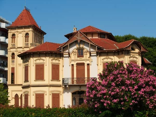
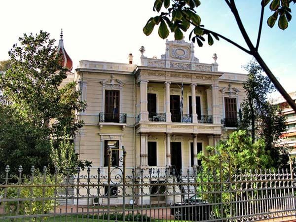
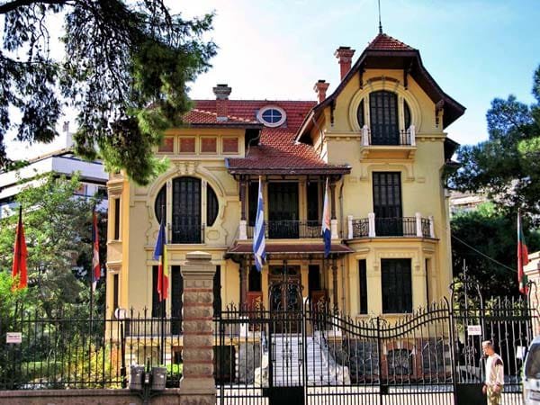
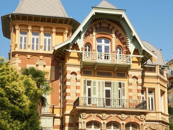
The ‘magnificent mansions’ that line the central avenue of Hamidiye stand as remarkable examples of architectural prowess and social stratification within the community. These grand residences are not merely structures of habitation; they are embodiments of power, wealth, and the cultural aspirations of their owners. Constructed during a period that emphasized both opulence and individuality, these mansions display a distinct blend of architectural traditions, influenced by local styles, as well as European elements, reflecting a nuanced interaction between different cultures.
Each mansion’s size and ornate design serve as a visual declaration of the owner’s social status. Larger homes, equipped with elaborate facades and extensive gardens, were often inhabited by affluent families. These families utilized their mansions not only as residences but also as venues for social gatherings, thereby enhancing their visibility and influence in the community. The architectural choices made—ranging from intricate moldings to spacious courtyards—were deliberate efforts to project an image of prestige and sophistication.
Furthermore, the placement of these mansions along the central avenue played a crucial role in their social implications. The prominence of their locations meant that they were easily visible to passersby, enabling the owners to reinforce their societal standing. The rich architectural details offered a stark contrast to simpler structures in adjacent areas, thus marking a clear distinction between different social classes. This phenomenon served not only to delineate economic disparities but also to foster a sense of community identity, where the architectural landscape became intertwined with social narratives.
In conclusion, the ‘magnificent mansions’ of Hamidiye are significant for both their architectural features and the social statements they make. They represent a crucial facet of the community’s historical narrative, showcasing the complex interplay between architecture, wealth, and social relations in the evolving urban landscape.
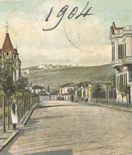
“Οι Πύργοι, οίτινες φαίνονται μεν προάστειον, χωριζόμενον από της πόλεως δια του Εβραϊκού νεκροταφείου, αποτελούν όντως μέρος αυτής, ως θερινή μάλλον αριστοκρατική συνοικία, είναι ο προσφιλέστερος περίπατος των Θεσσαλονικέων.
Είναι τα Πατήσια ή το Φάληρον των Αθηνών, το προάσιειον εκείνο το τελείως ευρωπαϊκόν την όψιν.“
Κ. Βουρδουνιώτης: “Οι Πύργοι της Θεσσαλονίκης“, Ημερολόγιον του Σκόκκου, 1894
Pyrgoi, which looks like a suburb, separated from the city by the Jewish cemetery, is indeed a part of it; as a rather aristocratic summer quarter, it is the favorite walk of the Thessalonians.
It is the Patisia or the Faliron of Athens, the suburb that is completely European in its eyes.
K. Vourdouniotis: “The Towers of Thessaloniki”, Diary of Skoko, 1894